@MartinPeer wrote:
Hallo everyone
First of all thanks to the emlid team to provide a system with this capabilities for a price range accessible to a lot of people (including me).
I am a total beginner on this field and probably the most of my questions are already answered in some way or another. The thing I want to do, and if desired to share, is producing a 3D model of a 30ha area I an alpine region with total elevation difference of 120m. If it is desired a little work report out of it I describe it better.
To get me started I need a basic issue solved:
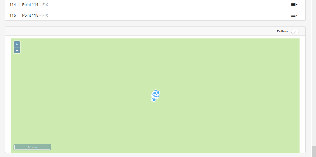
My rover does not measure its actual position but it gives me the position of the base stationI measured 115 points all fix with an auto rule of 10 s data collection precision 0.01m and DOP =2
The problem is that I moved the rover in an approximately 6m grid on a 0.6 ha field and all points collapsed on the position of the base station within a 1 cm circle. I mean, I appreciate the precision but I have a slight feeling down my guts that I have set up something horribly wrong.
following my app settings and a system reportSummary
Simple system report
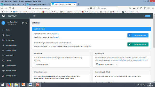
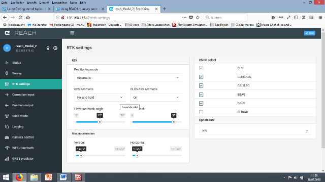
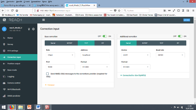
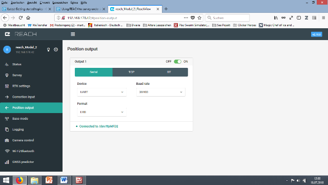
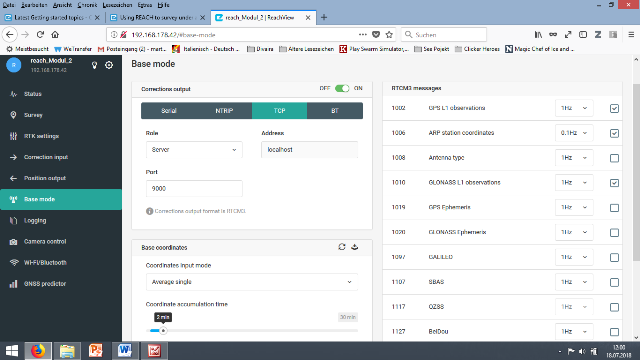
app version: 2.10.0-r0
'wifi_status, interface: wlan0':
- Client state
- IP address: 192.168.178.42
  mac address: 90:b6:86:02:5f:d8
  ssid: FRITZ!Box 7330
base mode:
  base coordinates:
    accumulation: '2'
    antenna offset:
      east: '0'
      north: '0'
      up: '0'
    coordinates:
    - '0'
    - '0'
    - '0'
    format: llh
    mode: single-and-hold
  output:
    enabled: true
    format: rtcm3
    path: tcpsvr://:9000#rtcm3
    type: tcpsvr
  rtcm3 messages:
    '1002':
      enabled: true
      frequency: '1'
    '1006':
      enabled: true
      frequency: '0.1'
    '1008':
      enabled: false
      frequency: '1'
    '1010':
      enabled: true
      frequency: '1'
    '1019':
      enabled: false
      frequency: '1'
    '1020':
      enabled: false
      frequency: '1'
    '1097':
      enabled: false
      frequency: '1'
    '1107':
      enabled: false
      frequency: '1'
    '1117':
      enabled: false
      frequency: '1'
    '1127':
      enabled: false
      frequency: '1'
bluetooth:
  discoverable: false
  enabled: false
  pin: '***'
camera:
  duty cycle: 20
  enable: false
  period: 2
  polarity: true
correction input:
  input2:
    enabled: true
    format: rtcm3
    path: localhost:9000
    send position to base: 'off'
    type: tcpcli
  input3:
    enabled: true
    format: rtcm3
    path: ttyMFD2:38400:8:n:1:off
    type: serial
logging:
  base:
    format: RTCM3
    started: true
    version: null
  correction:
    format: RTCM3
    started: true
    version: null
  interval: 24
  overwrite: true
  raw:
    format: UBX
    started: true
    version: null
  solution:
    format: LLH
    started: true
    version: null
position output:
  output1:
    enabled: true
    format: erb
    path: ttyMFD2:38400:8:n:1:off
    type: serial
  output2:
    enabled: true
    format: llh
    path: :2013
    type: tcpsvr
rtk settings:
  elevation mask angle: '15'
  glonass ar mode: 'on'
  gps ar mode: fix-and-hold
  max horizontal acceleration: '1'
  max vertical acceleration: '1'
  positioning mode: kinematic
  positioning systems:
    compass: false
    galileo: true
    glonass: true
    gps: true
    qzs: true
    qzss: true
    sbas: true
  snr mask: '35'
  update rate: '5'
 ).
).
Posts: 1
Participants: 1