Quantcast
Channel: Emlid Community Forum - Latest topics
Viewing all 12769 articles
Browse latest View live

Product inquiry

$
0
0

@palffyandras wrote:

Hi every one,
we are new to the positioning game. I have the following task: I need to know the relative (only the relative) position of a pedestrian/biker to a moving car with a minimum of ~30 cm accuracy, and log that position as frequently as possible. Distance between rover and base would be below 100 m all the time. My questions are:

  1. is that possible with 2 Reach M+? I would put one on the car as a base, and one on the pedestrian.
  2. Do I need a 3rd, fixed bas station instead?
  3. Do I need a sim card/mobile phone for RTK fix?
  4. Can I have the same setup with multiple rovers later on?
  5. how can I log the positions? Do you have a ROS interface by any chance?

Thanks a lot!
Andras

Posts: 1

Participants: 1

Read full topic


Help/ayuda

$
0
0

@kingping247 wrote:

hello good day I’m new in these and from Mexico and I have an emlid reach rs + team but I have a problem I could not match the antennas in android to do RTK I do not know how to do it since I did not understand well how to do it could help me step by step to be able to do a good job I would greatly appreciate it

Posts: 10

Participants: 3

Read full topic

Neutis N5- Getting A working Yocto build

$
0
0

@0xffff wrote:

I received my Neutis Dev Kit in yesterday. A very nicely build board.
Has anyone gotten the instructions on how to “Build your own Linux OS” here. to work ? and as a side note, why hasn’t EMLID added this full build to the download page over the neutis-minimal-image one? Yet another note, anyone have a clue how to get a debian baised version using yocto for this.

I followed those instructions on a VM (Virtual Box & VMWare Player) and after 6 hours of building I could not get the VM’s to connect to the board. UGh…(So for others be warned and try to connect first). I then installed Linux Ubuntu on my laptop, and before building I made sure Neutis Flasher would connect. It did so I started the build again and 4.5 hours later it was done successfully.

Now here is where things get unclear in the docs.
It says “You will find your image here: $BUILD/tmp/deploy/images/neutis-n5/*.sunxi-sdimg”
There are 2 files in that folder that can fulfill this statement, so which one is the correct one ?

#1) neutis-image-neutis-n5.sunxi-sdimg
#2) neutis-image-neutis-n5-20181002061537.rootfs.sunxi-sdimg.

In any event I tried both, and when the device boots up it gets stuck at “Starting kernel …”.
Below is the terminal output when its reset.

U-Boot SPL 2018.07-g8c5d4fd (Oct 02 2018 - 08:54:38 +0000)
DRAM: 512 MiB
Trying to boot from MMC2


U-Boot 2018.07-g8c5d4fd (Oct 02 2018 - 08:54:38 +0000) Allwinner Technology

CPU:   Allwinner H5 (SUN50I)
Model: Emlid Neutis N5
DRAM:  512 MiB
MMC:   SUNXI SD/MMC: 0, SUNXI SD/MMC: 1
Loading Environment from FAT... *** Warning - bad CRC, using default environment

Failed (-5)
In:    serial
Out:   serial
Err:   serial
Net:   No ethernet found.
starting USB...
No controllers found
Hit any key to stop autoboot:  0
switch to partitions #0, OK
mmc1(part 0) is current device
Scanning mmc 1:1...
Found U-Boot script /boot.scr
1870 bytes read in 1 ms (1.8 MiB/s)
## Executing script at 4fc00000
U-boot loaded from eMMC
403 bytes read in 0 ms
27247 bytes read in 2 ms (13 MiB/s)
266 bytes read in 1 ms (259.8 KiB/s)
Applying DT overlay sun50i-h5-spi0-status-okay.dtbo
577 bytes read in 2 ms (281.3 KiB/s)
Applying DT overlay sun50i-h5-uart1.dtbo
577 bytes read in 1 ms (563.5 KiB/s)
Applying DT overlay sun50i-h5-uart2.dtbo
577 bytes read in 1 ms (563.5 KiB/s)
Applying DT overlay sun50i-h5-uart3.dtbo
510 bytes read in 2 ms (249 KiB/s)
Applying DT overlay sun50i-h5-r-uart.dtbo
374 bytes read in 1 ms (365.2 KiB/s)
Applying DT overlay sun50i-h5-i2c0.dtbo
374 bytes read in 1 ms (365.2 KiB/s)
Applying DT overlay sun50i-h5-i2c1.dtbo
374 bytes read in 1 ms (365.2 KiB/s)
Applying DT overlay sun50i-h5-i2c2.dtbo
375 bytes read in 1 ms (366.2 KiB/s)
Applying DT overlay sun50i-h5-r-i2c.dtbo
504 bytes read in 2 ms (246.1 KiB/s)
Applying DT overlay sun50i-h5-usbhost0.dtbo
504 bytes read in 2 ms (246.1 KiB/s)
Applying DT overlay sun50i-h5-usbhost1.dtbo
504 bytes read in 1 ms (492.2 KiB/s)
Applying DT overlay sun50i-h5-usbhost2.dtbo
504 bytes read in 1 ms (492.2 KiB/s)
Applying DT overlay sun50i-h5-usbhost3.dtbo
532 bytes read in 1 ms (519.5 KiB/s)
Applying DT overlay sun50i-h5-ethernet-100.dtbo
363 bytes read in 1 ms (354.5 KiB/s)
Applying DT overlay sun50i-h5-analog-codec.dtbo
501 bytes read in 1 ms (489.3 KiB/s)
Applying DT overlay sun50i-h5-camera-status-okay.dtbo
1132 bytes read in 1 ms (1.1 MiB/s)
Applying DT overlay sun50i-h5-hdmi.dtbo
3254784 bytes read in 156 ms (19.9 MiB/s)
4509466 bytes read in 216 ms (19.9 MiB/s)
## Loading init Ramdisk from Legacy Image at 41080000 ...
   Image Name:   uInitrd
   Image Type:   AArch64 Linux RAMDisk Image (uncompressed)
   Data Size:    4509402 Bytes = 4.3 MiB
   Load Address: 00000000
   Entry Point:  00000000
   Verifying Checksum ... OK
## Flattened Device Tree blob at 4fa00000
   Booting using the fdt blob at 0x4fa00000
   Loading Ramdisk to 49bb3000, end 49fffeda ... OK
   reserving fdt memory region: addr=4fa00000 size=6c000
   Loading Device Tree to 0000000049b44000, end 0000000049bb2fff ... OK

Starting kernel ...

Posts: 1

Participants: 1

Read full topic

Reachview - Great work! and some suggestions

$
0
0

@Dave wrote:

Hi All,

I’ve been working with a pair of Reach RS+ for a few weeks now for surveying in a base-rover configuration using the LoRa radio, with the base on known coordinates in manual mode. I use the second Reach as a rover configured in kinematic mode. As others have experienced here, I have had difficulty getting a fix on the rover in some conditions, but able to get a solid fix in others or at different times. I’m continuing to read and understand the abilities and limitation of the hardware and technology. I’m quite impressed with what the Reach RS+ and Reachview can do, and I look forward to the development of Reachview as it progresses.

I have a few suggestions for Reachview that I would find helpful:

1 - The ability to save and recall configurations in Reachview. Specifically the NTRIP configurations (Server, username, password, mountpoint) as I use multiple providers, and it’s a pain to keep entering this info.

2 - I’m very interested in the potential of an RTK Stop-and-Go survey function in Reachview where Reachview could adjust the RTK mode automatically from static to kinematic, and back during field work. This method seems to perform better in point survey type situations, but currently the method of switching makes it tedious.

3 - Reachview integration with RAW files/data for post processing. The Reachview application is excellent and very user friendly, it would be great if it could utilize stop-and-go survey methods with recording of raw data to make the whole PPK process easier.

4 - Due to the nature of L1 GNSS surveying, there are some areas that are just not going to work for this due to tree canopy, etc. To work around this, I am using a Bluetooth rangefinder with integrated compass (LT TruPulse 360B) to take offset measurements from my GNSS position. MapIt! on android supports a Bluetooth connection and the ability to add these projected points. It would be GREAT if I could pair the TruPulse with the Reach RS+ Bluetooth and record the projected points right into Reachview.

5 - The ability to load an offline basemap into Reachview (or the reachview app) to replace the openstreetmaps basemap. I use the Reach in hotspot mode, and when it’s connected, the OSM basemap won’t load due to the lack of internet, so this would be a good workaround and allow for customization depending on the requirements of the project, and in areas with no internet access.

Anyway, these are my suggestions to date. I’m very impressed with the current state of Reachview and it’s ease and the ability to fully configure almost everything. Well done and thank you!

Best Regards,
Dave

Posts: 5

Participants: 4

Read full topic

REACH mm ACCURACY

$
0
0

@neganthesavior wrote:

Hello everyone,

I’m about to buy two reach units for ground control points for drone mapping in my country Bolivia. I was wondering if there’s a chance to get milimitre accuracy, less than 1 cm.

thanx in advanced

Marco Rios

Posts: 4

Participants: 3

Read full topic

Antenna calibration

$
0
0

@ojedajairo wrote:

Hello Emlid team,

In my country to do work that can be presented at the geographic institute, it requires that equipments appear on this page: https://www.ngs.noaa.gov/ANTCAL/

My question is, can Emlid Reach RS manage it so that its equipments appear on that page?, thanks

Postdata:, I already made my vote in the Wichmann Innovations Award.

Regards,

Jairo Ojeda

Posts: 2

Participants: 2

Read full topic

Reach RS overwriting not collecting new data

$
0
0

@jnrobertson wrote:

Yesterday, I noticed how the solution file of the Reach RS I am using did not store new data since the 5th of September 2018. I noticed two distinct problems:
First of all, before the 5th of September it was storing the data as the 21st of September 2017, any data taken was constantly being overwritten under this date inside the Reach RS, but was still collecting a correct timestamp.
Secondly, since the 5th of September, the filename is also set as the 21st of September 2017, but now it is not overwriting the data like it used to. I can use the RS if it is overwriting data, I simply download the data before taking new measurements. However, since it seems that no data has been taken since, I hope to find a solution for this.

Has this problem come up to you before? How did you solve it? What other information do you need from me to solve this problem?

Posts: 1

Participants: 1

Read full topic

Reach M+ Experience: sub-centimeter level accuracy

$
0
0

@kapejod wrote:

Hi,

i just wanted to share my experience with two Reach M+ which work great in a RTK setup.
Both devices connect to a wifi hotspot (or rather two hotspots). The stationary base sends correction data (over the internet) to the rover unit.

I have achived sub-centimeter level accuracy:

even with my very “basic” antenna setup:

As a “base plate” i have put aluminum foil inside the top of my backpack.

Cheers,

KP

Posts: 2

Participants: 2

Read full topic


Comparison between straight PPK from NTRIP RINEX and base-RINEX

$
0
0

@jurijs.jeshkins wrote:

I was going to process some results from our last expedition to Iceland and found one very strange thing.

Our workflow in the expedition was as following:

We were placing one Reach RS+ unit in the camp as a static base station in order to collect local satellite data. The data was used for processing our rover Reach RS+, which we took with us to the survey territory. The survey territory was about 7 km away from the camp. We were not using any RTK. Usage of local NTRIP casters in RTK mode was not possible due to poor GSM signal, that’s why we thought to do PPK afterwards with RINEX data. So, we were collecting raw log with base station and with rover, which afterwards we would combine in a following way: 1) correct base position with NTRIP caster RINEX files, 2) assign corrected coordinates to the base station and correct position of the rover against base station log file. Everything went fine and we got ~50% of all log in FIX status. Base station log was 98% FIX with average error of 5 mm. The NTRIP caster base was ~40-45 km away, so I assume, that total error might be around 5-7 cm, according to the formula of 7mm + 1mm/km.

Then, I tried to do the same correction to the rover, but against RINEX data straight forward, without using local base. And I got a track file, which in comparison to previous results was 1.5-3 (!!!) m off. I have no idea, what can be wrong. All the same processing parameters were used, so I prepared to see straight RINEX aproach track to be off some 10 cm, but not meters!

After finding this issue, I tried to do the same workflow here, in Latvia, and I see, that track is constantly off some 30-40 cm (RINEX base station is 1.5km away, Reach RS+ base station was ~300 m away). At some points, I see, that the shift is larger depending on the direction, which I was moving. This can be described with poor PDOP, but in Iceland data I don’t see the same clues.

Where the problem is hiding? What can be a solution to this problem?

Attached are files from the experiment in Latvia, if someone wants to check them. I would appreciate, if someone could.
dac_rover_base_experiment - Copy.zip (6.7 MB)

P.S.: I consider to trust Reach RS+ base station in Iceland, than local RINEX, because base station was only 7km away, in comparison to RINEX data.

Posts: 1

Participants: 1

Read full topic

Collection points in QGIS

$
0
0

@And_Nz wrote:

I not have problems to connecting the Reach to my QGIS, by GPS Information Panel, but for save points, do not is a tools effective to me.
There is some Qgis Plugin with which save points automatic, programming for different change, distance horizontal, or vertical, time interval or other.
I am using Magnet Field Topcon for my work of agriculture of precision, and I would like the workflow be similar.

thanks you very much for the help of all

Posts: 1

Participants: 1

Read full topic

Reach and Reach Rs

$
0
0

@v.muscio wrote:

Hi friend… …
i have 2 reach emlid that comunicate with a radio rfd (europe transmission).
i would like to buy a reach rs,

  • if possible to use 2 base for correction (reach emlid) a rover (reach rs)
  • it is better to use the reach rs as a base or a rover?

thanks…

Posts: 4

Participants: 3

Read full topic

In the USA? Using RTN? And ArcGIS Collector? Read This

$
0
0

@electricblue wrote:

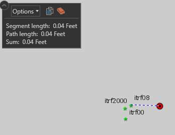
OK I’ve finally got this thing figured out. I just collected some data that was off 1.2cm, thats a ‘maybe I didn’t quite level the pole perfectly’ type error, altitude was off the same distance just amazing accuracy for what I need. Here’s a screenshot of it
image
I wanted to share my settings for those who come to the Reach RS+ in my single rover situation and don’t care to fumble around trying to figure it out like I did

Settings for the RS+ Rover
RTK SETTINGS
Positioning mode: Static
GPS AR mode: Continuous
GLONASS AR mode: On
Elevation mask angle: 20
SNR mask: 35
Max acceleration: 0 for both vertical and horizontal
GNSS select: all checked but BEIDOU
Update rate: 1Hz

Correction input
NTRIP
Mount Point: VRS_RTCM31 (someone told me CMR is trimble proprietary? :man_shrugging: CMRX and Plus didn’t work for me in any case)
Format: RTCM3
Check Send NMEA GGA messages to the corrections provider
(Obviously these will be different if you’re not using VRS, have some other input method.)

Position output
BT (bluetooth, you must use an Android device for this to work, i’ve not tried it with Collector on my Win10 laptop but that might work too)
Format: NMEA

You will know this is all working right when you go into Status and see numbers for ROV: and BASE: and your solution status says RTK FIX, which may take a couple minutes. Under RTK parameters before you capture a point you want to see the age of differential as low as possible, AR validation ratio as high as possible and baseline? I dunno…baseline was all over the place and didn’t really have any correlation to my accuracy from what I could tell, that might have to do with my corrections which I’ll get to now.

ArcGIS Collector Settings
Reach RS+ works in WGS84 only, but in the USA we use GCS_NAD83_2011 till 2022 for some reason so most likely if you’re in the US your corrections from your RTN are going to be in the wrong datum. Luckily, they aren’t THAT different and we can make it work without buying more stuff. To make it work you’ll want to author a map in ArcGIS Online in WGS84 (just search for an ESRI WGS84 basemap and replace the basemap that you have) then in Collector’s All maps screen hit the 3 dots in the lower right and go to Settings

Collection
Streaming interval: 1 sec
Style: Single - Collect a single feature at a time
GPS averaging: OFF

Location
Accuracy: 10cm
95% Confidence: ON(? Not really sure this does anything useful)
Location provider: Here’s where you’ll see your rover if Bluetooth is working right, make sure you add in the antenna height to the bottom of the receiver
Location profile: OK here’s the important part
GNSS Reciever Coordinate System: GCS NAD 1983 2011
Map Coordinate System: GCS WGS 1984
Datum Transformation: wgs_1984_(itrf08)_to_nad_1983_2011 (you can see above this transformation is the best in CONUS, I tried everything)

Posts: 1

Participants: 1

Read full topic

Navio2 error issue!

$
0
0

@mjc1521 wrote:

Hello all,
I am currently new at building my own drone. I am having an issue with my Navio2. I have used the command sudo nano /etc/default/arducopter to set my TELEM 1 to my IP address of my GCS. I then use the command sudo arducopter -A udp:“IP address”:14550. When I use this command, I get the following error:
Could not detect RPi version, defaulting to 2/3
MS5611 found on bus 1 address 0x77
PANIC: AP_Baro::read unsuccessful for more than 500ms in AP_Baro::calibrate [2]

*** Error in `arducopter’: double free or corruption (out): 0x0202ce80 ***
Aborted
Because of this, I can not connect to APM Planner 2 and can not calibrate the Navio2. Does anyone know why I am getting this error? FYI, I am using arducopter 3.5, and both my ardupilot and RCIO are up to date.

Posts: 1

Participants: 1

Read full topic

Reach M+ wiring with Foxtech A7R

$
0
0

@AeroScan wrote:

I am trying to set up a Foxtech A7R camera (modified Sony A7R) with Reach M+ for PPK.

A diagram of the camera wiring harness is below.

I am powering the Reach M+ through S1 pins 1 and 6.
I would like to know how to connect the hot shoe wires to the Reach.

My understanding is that I should connect the camera white wire (labelled 4. Hot Shoe PPK) to Reach C1 pin 2, and the trigger ground wire (3. Green Cable: GND) to Reach C1 pin 1.

If someone can confirm this or tell me why I’m wrong I would be most grateful- I don’t want to damage my Reach!

Posts: 1

Participants: 1

Read full topic

When the signal tracking L2 will be included in Reach RS + ...?

$
0
0

@juanluischq wrote:

Good morning, dear friends, I am new to this community and I have certain doubts:

  • Having a base control point at a distance of approximately 60 km, as I can link two Reach RS + in static mode, 2 hours at a distance of 3 km. Knowing that its limitation has a base frequency of L1 and not L2 … How do you solve it …?

  • For when will they include the satellite frequency L2 or L5 in the Reach RS + model?

  • In the city of La Paz / Bolivia we normally buy local base station base points, when purchasing they are in rinex format. Ask how would you link with Reach RS + by performing a base linear adjustment in the Trimble Busin Center (TBC) program …?

Again, thank you for your response time, very attentively Juan Luis
La Paz, Bolivia
juanluischq@gmail.com

Posts: 5

Participants: 4

Read full topic


Using Webcam (UVC camera) on Emlid Edge with GCS

$
0
0

@fako wrote:

Hi everybody,

I’ve searched for a long time about how to use a USB camera on Emlid Edge. But I’m still stuck.

I’ve connected a USB camera on Edge’s USB 1 port. The device is available under:
/dev/video0

I was able to broadcast the video to my computer (and to see it) using this command, during ssh connection:
$ gst-launch-1.0 v4l2src device=/dev/video0 ! video/x-raw,width=640,height=480,framerate=\(fraction\)30/1 ! videoconvert ! jpegenc ! udpsink host=192.168.0.112 port=5000

Apparently, ‘/usr/bin/csd’ binary manages video streaming; 14% of CPU load when the video starts on QGC. This binary is released in firmware, so no access to the source code if I have understood correctly.

2 questions:

1- Is it possible to stream USB camera to QGC directly with GStreamer? In this case, if no HDMI camera is connected to Emlid Edge, does that make sense on CPU load?

2- If not, is it possible in Emlid Edge to modify a configuration file to use USB camera (for example /dev/video0) instead of HDMI-IN ?

Thank you.

Posts: 1

Participants: 1

Read full topic

Reach M+ and Phantom 4 shutter timing. Anyone figured it out?

$
0
0

@wsurvey wrote:

Hello,

I have made my own rig to carry a reach M+, antenna and usb battery around in order to PPK my mission. I’m just extracting elevations and positions from the PPK track. Without being able to tap into the shutter signal, the horizontal position is obviously far looser than height. Has anyone managed to find a place to tap into in order to send the shutter signal into the reach M+ event time port?

I spent a little while in the phantom poking around trying to find a pin that carried the shutter signal to no avail.

The LED next to the SD port seems to go out when capturing a photo so I thought about soldering onto this, or the front LED, but blinking off seems to be the opposite of what is needed. Also wiring diagrams seem and pin assignments for the P4P seem to be hard to come by. Has anyone figured this out?

Cheers.

Posts: 1

Participants: 1

Read full topic

Introducing LoRa Radio for Reach M+

$
0
0

@dmitriy.ershov wrote:

Today we release the long-awaited LoRa radio for Reach M+!

The new radio module works at the same frequency range as Reach RS/RS+ LoRa (862–1020 MHz). The module is fully compatible with the internal LoRa radio of Reach RS/RS+.


LoRa for Reach M+ enables easy and reliable RTK communication between Reach RS/RS+ base station and Reach M+ rover on distances up to 8 kilometers.

It’s easy to integrate:

  • Plug the radio to S2 port on Reach M+ with the supplied cable;
  • Setup correction link between M+ and RS/RS+ in ReachView app over LoRa (LoRa radio requires Reachview v2.15.3 dev and higher).

LoRa radio is now available for order from Emlid store for $118 (also available from our dealers). Learn more about LoRa radio in Emlid docs and order one now in our online store!

Posts: 3

Participants: 2

Read full topic

There is no cfs_period_us or cpu.cfs_quota_us in the cgroup

$
0
0

@zivyfeng wrote:

Hi guys,

I recently use cgroup to limit the resources, while when I install cgroups-lite, it shows

$ sudo apt install cgroups-lite
Reading package lists… Done
Building dependency tree
Reading state information… Done
E: Unable to locate package cgroups-lite

But I have successfully installed cgroup-bin cgroup-lite cgroup-tools cgroupfs-mount libcgroup1

And there is no cfs_period_us or cfs_quota_us in the /sys/fs/cgroup/cpu.

pi@navio:/sys/fs/cgroup/cpu $ ls
cgroup.clone_children cpuacct.stat cpu.shares tasks
cgroup.procs cpuacct.usage notify_on_release
cgroup.sane_behavior cpuacct.usage_percpu release_agent

My kernel is

Linux navio 4.4.36-a7765e7-emlid-v7+ #41 SMP PREEMPT Mon Mar 20 18:48:32 MSK 2017 armv7l GNU/Linux

Does anyone can help, thank you!

Posts: 1

Participants: 1

Read full topic

Issue with battery on Reach RS

$
0
0

@arsl wrote:

Hi,
We have a similar problem with one of our Reach units where even if we leave it charging overnight the power doesn’t seem to increase beyond 50% when unplugged and then drains very quickly. Normally we could work around this by carrying a portable cell phone charger into the field but yesterday after charging all night, when we went to turn it on we got the solid orange and blue LEDs indicating an internal error, and the unit would only turn on if it was plugged into an external power source. After leaving plugged in for a couple hours the unit recovered and became functional but now it seems to have nearly no battery life whatsoever where it doesn’t seem to hold a charge for more than 30min without external power.
When I generated the detailed system report in the battery status report it said:
● battery.service
Loaded: not-found (Reason: No such file or directory)
Active: inactive (dead)

The unit has ReachView version: v2.15.3 Dev

In the Reach set up log there were some errors:

And throughout the file info about the battery like this one:

Is this a software problem where I should reflash the unit or indicate of potentially a hardware failure? I can upload the full logs also if that’s helpful.

Thank you,

Margaret

Posts: 1

Participants: 1

Read full topic

Viewing all 12769 articles
Browse latest View live